
Serving Proudly As The Voice Of Valley County Since 1913
Serving Proudly As The Voice Of Valley County Since 1913
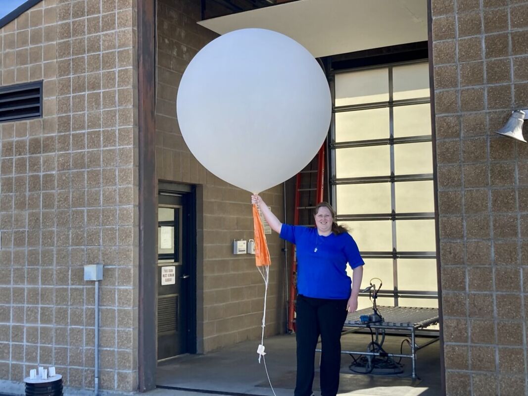
Meteorologist of the Glasgow Weather Service Julianna Glinskas launched a weather balloon on Sept. 27 to help provide support for the National Hurricane Center and provide assistance to meteorologists who were forecasting Hurricane Ian, which hit landfall on the east coast last week.
In a typical week, the National Weather Service (NWS) launches two weather balloons per day, one early in the morning and one in the late afternoon/early evening. The purpose of these balloons is to collect atmospheric information such as temperature, humidity, pressure and wind. The information collected is then utilized in weather models, which are used to help meteorologists predict the weather. When high impact weather is expected, additional weather balloon launches are necessary to produce additional observations in order to gain the most accurate forecasts.
The Glasgow Weather Service launched two additional weather balloons each day, once every six hours, for a period of a few days last week, in order to give the models additional information in an attempt to improve forecasting for the hurricane. Many other National Weather Services throughout the United States also launched the extra balloons daily to gain additional information.
According to the NWS Glasgow, weather patterns on a large scale have influence on smaller systems which can drive how these systems evolve and move. As a result, it's important to know what is happening throughout the lower atmosphere across the entire country in order to help increase confidence in forecasting the track of these systems.
Though Montana seems a long ways away from the east coast, especially the areas Hurricane Ian hit, which included Florida and the Carolinas, observations provided by the extra weather balloons launched here, and elsewhere throughout the country, helped increase confidence in forecasting the tracks of the Hurricane Ian system.
Reader Comments(0)