

Serving Proudly As The Voice Of Valley County Since 1913
Serving Proudly As The Voice Of Valley County Since 1913
Farmers Fear Irrigation Impacts, Damage to Lands
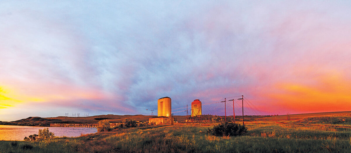
Sunset casts a warm glow on the Fort Peck Dam Powerhouses and receding storm clouds on July 7.
The Army Corps of Engineers surveyed irrigation sights between July 8 and 17, as part of a study into plans to alter the rate of water release from Fort Peck Dam in the coming years to test the potential for Pallid Sturgeon recovery in the river below the dam. The change in flows will test whether or not increasing flows and then decreasing them throughout the season will attract the ecologically extinct Pallid Sturgeon to spawn in the river system. Farmers along the Missouri River fear those increases and decreases will harm their irrigation equipment or render it useless during critical irrigating timeframes.
The Missouri River between Fort Peck Dam and Lake Sacajawea is home to three endangered species-the Least Tern, the Piping Plover and the Pallid Sturgeon. Because of those endangered species the Army Corps of Engineers must consult with the U.S. Fish and Wildlife Service to develop plans for species recovery in the river system.
The federal agencies established the Missouri River Recovery Implementation Committee in response to the need for a plan to recover those species. In 2011, that committee established an Independent Science Advisory Panel to study possible methods for improving Pallid Sturgeon viability in the Missouri-a habitat where the species has been in constant ecological peril but still shows signs of natural spawning and possible recruitment.
One of the study's hypotheses posits that the species may show more "recruitment" from embryo to survivable fish if the river flow in the Missouri River was increased to induce spawning near Fort Peck and then reduced sharply to allow the drifting embryos to form into fish before reaching Lake Sacajawea where predation and other factors are likely wiping out the generation of fish before they join the population.
To test the hypothesis the Corps is planning to increase the rivers flow to around 28,000 to 33,000 cubic feet per second (cfs) early in the Spring runoff season. The elevated flow level is expected to induce a natural response in the sturgeon to migrate up river and seek areas to spawn.
Shortly after the spawning period, the Corps will reduce flows in the river to roughly 8,000 cfs to slow the drift of sturgeon larvae. By slowing the drift considerably, biologists hope the slowly forming fish will be mature enough to survive on their own before reaching Lake Sacajawea downstream in North Dakota.
The first flow test for the study is projected to occur in 2022. To approve a plan to increase and decrease flows, the Corps must undergo an Environmental Impact Statement process under the National Environmental Protection Act that they will publish when complete. Once published the federal government will open the EIS up to a public comment period and will hear input from the public on potential impacts to the environment and the economy as a result of the decision.
For farmers like Mike Ames and Ron Garwood, who irrigate along the Missouri River, the prospect of increasing the flow of the river into the 30,000 cfs range and then decreasing it to less than 8,000 cfs is unnerving. For starters, they both say that such an increase will erode land from their property at an alarming rate, effectively washing away value, capacity and revenue over time, but they also have greater concerns.
For Garwood, when the water is pumping out of the dam spillway at high rates, it deposits junk, debris and sand on top of his pump sites that requires money, time and resources to remove each year. A process he says is constant in any year but worse when the water is high. For Ames, a high flow rate will require retrofitting pump sites to be able to operate at higher and lower flow rates. A cost of tens of thousands of dollars for each pump location (he has four separate sites and multiple pumps and pivots).
On the opposite end of the flow rates, other problems occur. For Ames, the low flow rate will require attaching more pipe to the pump sites at another cost of tens of thousands per site. That enables the pumps to reach depths of four feet required to move water into the irrigation system and water crops.
For Garwood though, moving pump sites is not an option. His pumps are on the same pumping location they have been on since the 1940s and it would require a completely new system to move them today. That is a cost he says he could not absorb.
"I've never had to mess with it since I took over in '69," said Garwood. "I know I couldn't move it."
He pointed out that this is not the first time such a measure has been proposed for the dam. He recalls a similar discussion over twenty years ago that would have reduced flows into the 3,000 cfs range. "Even at 5,000 cfs, we still couldn't irrigate," said Garwood.
The high flows also bring back memories of the 2011 flood which brought the river flow up into the 66,000 cfs range. Garwood explained that after the 2011 floodwaters receded, everything along the river had changed. Land had eroded, sediment had deposited and things were swept away by the high, fast-moving water. Even a small version each year in the 30,000 cfs range would be bad for his farming operation. As Garwood put it, "We just couldn't live with that much water coming out."
Prior to the 66,000 cfs flow in 2011, the highest the flow out of Fort Peck Dam had ever been was in 1975 when it reached a flow rate of 35,000 cfs. That puts 33,000 cfs on the high end of flow rates for any year since the dams construction.
Ames says that if his farming operation were to lose the dependability of the river system each year, it could cost the farm about 50 percent of its production capability. That loss would amount to almost a million dollars in reduced net revenue a year. He explained that how the crop is watered in June-the time frame flows will be fluctuating-sets the seasonal yields and quality of the crop. Without a reliable June then, Ames contends, the crop quality and yield would not be dependable.
The Draft EIS from the surveys and the plan will be published in December of 2020. At that point there will be a 60-day review period and public comments will be opened up. Public meetings are expected to be held in January and February of 2021. The Final EIS and Record of Decision are expected in August and October of next year, respectively. More information-to include the entire MRRP-is available at https://www.nwo.usace.army.mil/MRRP/.


Reader Comments(0)